

Loading panorama viewer ...
Configuring ...
© 2008 James Gentles, All Rights Reserved.
Caption
Pittenweem is a small secluded village with a bustling colourful harbour in the south east corner of Fife, Scotland, UK.Probably used as a harbour from early times, if you look past the harbour wall to the west you can see the skerries (fingers of rock) that make a good place to draw-up small boats.
As the fishing community prospered the seafront houses were built with a strong Low Country (Belgium & Netherlands) influence with pan-tiled roofs brought over from the Continent as balast in trading vessels. As the community grew the town expanded up the hill, onto the raised beach, this aerial view clearly shows the delineation of old and new with the row of gardens between.
This small harbour remains vibrant and busy, as well as the tourists, there are daily fish markets in the large red roofed building on the pier.
Learn more about Kite Aerial Photography at http://www.gentles.info/KAP/
Location
Lat: 56° 12' 42" N
Long: 3° 44' 45" W
Elevation: 0m, camera at 150ft
Precision is: High. Pinpoints the exact spot.
Equipment
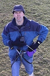
Nikon 8400 with FC-E9 Lens. Home-made camera cradle / rig, triggered by a gentLED intervalometer. Suspended below a Dan Leigh Cruiser R8 kite with 10ft/3m span. This technique produces two hemispheres, and a different workflow in PTGui from the classic ground pano technique. This results in lower resolution BUT impossible angles!
See the rig at http://www.gentles.info/KAP/Rigs/index.htm?item=7 how Kite Aerial Photography is achieved at http://www.gentles.info/KAP/Overview/index.htm and the workflow at http://www.gentles.info/KAP/Gallery/Panotechnique/index.htm
 Tap or click the zoom icon in the bottom right corner of the picture to switch between in-page and fullscreen view