

Ballintoy Harbour
Secluded Harbour on the North Antrim Coast of Northern Ireland, UK
22nd March 2008, 16:01 U
Loading panorama viewer ...
Configuring ...
© 2008 James Gentles, All Rights Reserved.
Caption
Once a busy little village harbour, this area fell into disuse with a move to bigger fishing vessels and the closure of the lime kilns & local quarry some time ago.In recent times the harbour has been re-born. With a refurbishment of the harbour itself, it is now an infrequent haven for small boats and a popular tourist starting point for walks along the coast which has many hidden coves, caves, and rock formations.
Out to sea Sheep Island can be seen with the larger Rathlin Island in the distance behind. On land the remains of the Lime Kilns can still be seen, along with the harbour office, now a welcoming tea-room.
A more recent addition is the first house on the left as the road climbs out of the harbour, Bendhu, the art-deco creation of Newton Penprase. The idea of a house designed by an artist's creativity over a lifetime doesn't meet society's needs for building control, but this unique structure has become accepted as another part of the harbour.
Location
Lat: 55° 14' 41.3" N
Long: 7° 23' 6.5" W
Elevation: ground 0m, camera 30m
Precision is: High. Pinpoints the exact spot.
Equipment
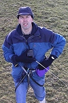
Nikon 8400 with FC-E9 Lens. Home-made camera cradle / rig, triggered by a gentLED intervalometer. Suspended below a mini-KAPilot kite approximately 16ft^2 area.This technique produces two hemispheres, and a different workflow in PTGui from the classic ground pano technique. This results in lower resolution BUT impossible angles!
See the rig at http://www.gentles.info/KAP/Rigs/index.htm?item=7 how Kite Aerial Photography is achieved at http://www.gentles.info/KAP/Overview/index.htm and the workflow at http://www.gentles.info/KAP/Gallery/Panotechnique/index.htm
 Tap or click the zoom icon in the bottom right corner of the picture to switch between in-page and fullscreen view