Scotland — How it used to be?
Beecraigs, near Bathgate, West Lothian, Scotland, UK
Tuesday, June 14, 2011, 09:59 local 10:59 U
© 2011 James Gentles, All Rights Reserved.
Re-forestation in the 20th Century was on a industrial scale, with "plantations" rather than "forests." Impenetrable wooded areas, of non-native trees, only useful for the timber harvest. More recent planting has thankfully been more sympathetic.
Although this view doesn't contain any of Scotland's signature trees (like the Scots Pine) it is probably a lot more representative of the lightly wooded forests that covered the land 100s of years ago. On the horizon (if you know where to look) 21st Century life continues with farmland, plantations, a radio mast, towns and an oil refinery.
Lat: 55° 56' 16.08" N
Long: 4° 37' 52.92" W
Elevation: 280m ASL + 35m AGL
Precision is: Medium. Nearby, but not to the last decimal.
This technique produces two hemispheres, and a different workflow in PTGui from the classic ground pano technique. This results in lower resolution BUT impossible angles!
See the rig, how Kite Aerial Photography is achieved, and the workflow.
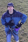
After some thought, a few walks, and advice from others, I found a reasonably exposed area (to get good wind - we cant afford the kite to come down on top of the trees), with a clearing to launch the kite on the windward side (to make it easy to retreat to safety), complete with low density trees (what we're trying to photograph!).
Then you wait for the right conditions.
When they arrived everything was fine, except the sun was a little shy. I launched the kite from the clearing. Once high in the sky the kite became stable enough to attach the camera that weighs 1.4Kg (3lbs). Always a nervous time as the fisheye lens has no protection should it touch the ground.
Let out more line and the camera climbed, then I walked into the trees, waiting for the sun to come through the clouds, always making sure I had a exit route back to the "safe" launch area.
The camera automatically took over 200 images, many were rejected, either for lack of sunlight, poor composition, or camera movement - only one was used for the final picture - hopefully you like the results!


 Tap or click the zoom icon in the bottom right corner of the picture to switch between in-page and fullscreen view