© 2022 James Gentles, All Rights Reserved.
You are floating above the waters of the Firth of Forth, a large estuarial inlet in Scotland's east coast which almost tears the country in half. Before 1890 it's a 50mile round trip to Stirling and the nearest bridge, Stirling Bridge.
The story starts in the 11th century, when Queen Margaret gave her name to the communities that sprung up around a narrow point in the water on the route between the ancient and modern capitals of Scotland - Dunfermline and Edinburgh. So, the towns of North Queensferry and (South) Queensferry can trace their roots back over 900 years with their royal patronage.
The view when this page starts is looking north across the water to North Queensferry through the 1964 Suspension bridge. Hiding behind is the huge structure of the Forth Bridge (UNESCO World Heritage Site)1890 carrying the railway north. Look to the left, we see the third bridge, the cable-stay Queensferry Crossing (2010).
These bridges are large, and are not the longest in the world, but nowhere else can you see 3 bridges this close together, that were built in 3 different centuries, each using the ground-breaking technology of the day: right to left Cantilever, Suspension and cable-stay.
Lat: 55° 59' 36.599" N
Long: 4° 25' 29.413" W
Precision is: High. Pinpoints the exact spot.
4 GoPro HERO3+ cameras, with a wooden camera cradle/rig to hold the cameras in exactly the correct position, is triggered by 4 custom designed camera synchronizers.
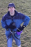
Suspended below a Dan Leigh Cruiser kite with 8ft/2.5m span.
This technique produces two hemispheres, and a different workflow in PTGui from the classic ground pano technique. This results in extra effort BUT impossible angles!
The camera rig: http://www.gentles.info/KAP/Rigs/index.htm?item=16
how Kite Aerial Photography is achieved http://www.gentles.info/KAP/Overview/index.htm and the workflow http://www.gentles.info/KAP/Gallery/Panotechnique/index.htm


 Tap or click the zoom icon in the bottom right corner of the picture to switch between in-page and fullscreen view