

Loading panorama viewer ...
Configuring ...
© 2006 John Leith, All Rights Reserved.
Caption
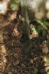
Happy ValleyThis is a small section of burn (stream) which in the late 40s or early 50s the owner of the land (Edwin Harrold) made into a wildlife garden with lots of trees.
Location
Lat: 58° 58' 36.78" N
Long: 4° 11' 23.57" W
Elevation: 50
Precision is: Unknown / Undeclared.
Equipment
Nikon D50, Panasorus, Velbon tripod, Suretred rubber boots
 Tap or click the zoom icon in the bottom right corner of the picture to switch between in-page and fullscreen view